RURAL & DRONE MAPPING SURVEYS
Civsurv offers comprehensive rural land surveying solutions across New South Wales, providing tailored services for landowners, developers, and government bodies working with large or complex properties.
With deep expertise in rural subdivisions, our team has successfully delivered projects involving extensive land parcels, intricate cadastral boundaries, and detailed analysis of historical survey data. We’re well-versed in resolving challenges such as irregular lot shapes, complex easements, and interpreting legacy title information to produce accurate, compliant subdivision plans.
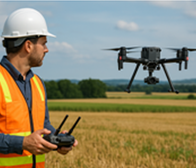
To enhance the efficiency and precision of rural surveys, we integrate advanced drone mapping technology into our workflow. Using UAVs equipped with high-resolution imaging and GPS systems, we capture detailed topographic data across vast or difficult-to-access terrain. This allows us to generate accurate digital elevation models, orthophotos, and 3D site representations — all of which support better planning, design, and land analysis.
Drone surveys are especially valuable in rural areas where traditional ground surveying is time-consuming or impractical due to landscape or property size.
Why Choose CivSurv?- Expertise in large-scale rural subdivisions
- Specialisation in interpreting old title and survey records
- Accurate mapping of complex easements and boundaries
- Integration of drone technology for efficient data capture and site modelling
- Fully licensed and experienced surveyors